
通用数据采集软件/ 3DSS Data Collection Software
cloud services

-
功能(Functions)
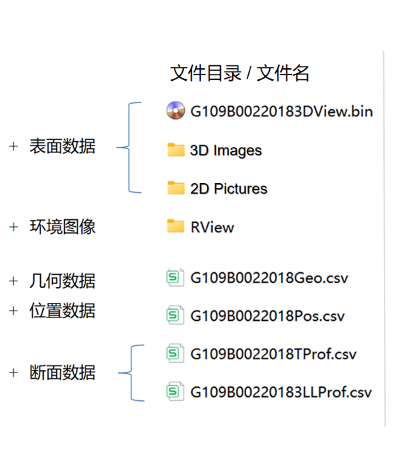
3DSS通用数据采集软件,是专门为各类3DLS激光传感单元设计开发的配套工程软件,包括3DSS-HR干线公路数据采集软件、3DSS-LR农村公路数据采集软件、3DSS-AR机场跑道数据采集软件等。各类3DSS数据采集软件,具有通用的系统架构设计和不同的系统功能。3DSS通用数据采集软件,能够在测量过程中,实时生成、实时显示、实时存储各类测量数据,包括3D深度图、2D灰度图、纵断面、横断面、纹理断面、空间几何和地理位置等测量信息。 3DSS software (3D Surface Scanning software) is the proprietary control platform for the iSCAN system, enabling comprehensive management of infrastructure surface scanning operations. It provides real-time visualization and presentation of multi-dimensional data, including 3D images, 2D pictures, longitudinal profiles, transverse profiles, texture profiles, geometry parameters, distance and GNSS information. The software supports dynamic data streaming during scans, allowing operators to monitor quality and adjust scan parameters instantaneously. All datasets, raw and processed, can be exported in industry-standard formats (e.g., CSV) for offline detailed analysis and distress auto-recognition.
联系我们
地 址:北京市海淀区,京仪科技大厦 B座
电 话:15101686516
网 址:www.intesensors.com.cn
邮 箱:cnlurylu@foxmail.com